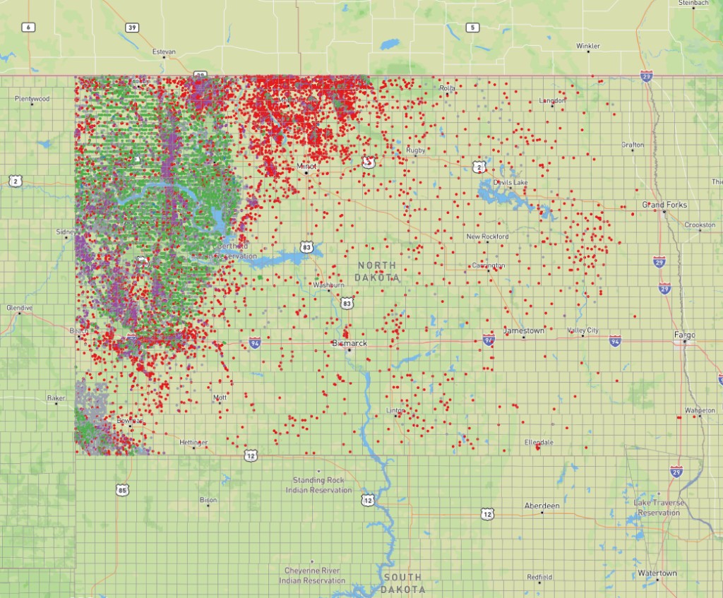
North Dakota PLSS: Bakken Basin Well Permitting with the 5th Principal Meridian
How to read North Dakota PLSS legal descriptions for Bakken Formation APD filings: the 5th Principal Meridian, Dickinson Field Office routing, 1,280-acre spacing units, and cross-state work at the Montana line.
A Bakken Formation APD package that crosses counties or the state line into Montana carries legal descriptions from two different meridian systems, different field offices, and sometimes different agencies. The PLSS descriptions that look straightforward on a lease exhibit can silently point to the wrong section if the meridian is assumed rather than confirmed. This guide covers how North Dakota's grid is organized, where the Bakken sits in PLSS coordinates, how the BLM Dickinson Field Office routes filings, and what changes the moment you cross into Montana.
The 5th Principal Meridian: North Dakota's grid foundation
North Dakota sits almost entirely within the 5th Principal Meridian survey. Its initial point is in Arkansas, and township numbering counts north from a baseline in Missouri. Every parcel in the Bakken Basin carries a legal description referenced to that single origin.
The exception is a small area in the state's northeastern corner under the 4th Principal Meridian (Minnesota and Wisconsin). For all Bakken work in McKenzie, Williams, Mountrail, and Dunn counties, the answer is always the 5th Principal Meridian. The Bakken core sits at T150N to T160N. The PLSS reference guide shows how township numbering works from any meridian's baseline.
Bakken Formation geography: PLSS addresses for active operators
The four counties at the center of North Dakota Bakken production each have a PLSS address range that matters for lease work and APD filing:
- McKenzie County: the geographic center of the ND Bakken. Most active drilling runs from T150N to T157N, R95W to R105W. Watford City sits near T150N R101W.
- Williams County: the northern edge of the core play, T155N to T160N, R95W to R105W. Williston is at roughly T152N R102W.
- Mountrail County: the southern and eastern extension, T153N to T159N, R85W to R93W. Stanley is at approximately T155N R90W.
- Dunn County: the southeastern end of the Bakken trend, T144N to T150N, R90W to R100W. Killdeer sits near T146N R95W.
A representative Bakken legal description: T155N R95W Sec 22 NE¼SW¼, 5th Principal Meridian places you in Dunn County at a 40-acre parcel inside a 640-acre section. That description goes on both the NDIC state permit and on BLM Form 3160-3 for any federal mineral estate within that section.
Range numbers look similar to Wyoming (R60W to R105W on the 6th Principal Meridian), but the origin is different. T155N R95W on the 5th Principal Meridian is not the same location as T155N R95W on the 6th. Enter any ND legal description into the North Dakota PLSS converter to confirm coordinates before they go on a permit form.
BLM Dickinson Field Office: federal APD routing in the Bakken
Federal mineral estate runs beneath significant portions of the Bakken core, and APDs on that estate route through the BLM Dickinson Field Office, which handles all four core Bakken counties. Form 3160-3 must carry the principal meridian written in full ("5th Principal Meridian"), Township and Range with direction stated (T150N to T160N, R80W to R105W), Section 1 through 36, aliquot part down to the quarter-quarter or government lot, WGS84 coordinates to six decimal places, and footage from section lines.
BLM's WellSTAR system validates the PLSS description against CadNSDI survey data at submission. If the Township, Range, and Section combination does not exist, or if coordinates fall outside the described section, the application returns for correction before a reviewer sees it. The broader APD validation workflow is covered in the PLSS APD workflow guide.
Horizontal well spacing units: 1,280-acre units and the PLSS description
The Bakken Formation is produced almost entirely through horizontal drilling. North Dakota's NDIC establishes drilling spacing units (DSUs) that govern where wells can be placed. The dominant spacing for Bakken horizontals is the 1,280-acre spacing unit, covering two full sections within one township.
A 1,280-acre unit made up of Sections 22 and 27 in T155N R95W runs the lateral wellbore from one section into the adjacent one. The surface location sits in one section; the lateral terminus often extends into the other. That creates two separate legal description requirements on one APD:
- Surface location: T155N R95W Sec 22 SW¼SE¼, 5th Principal Meridian. This determines BLM field office routing for federal minerals.
- Bottom hole location: T155N R95W Sec 27 NW¼NE¼, 5th Principal Meridian.
Both descriptions must be correct and internally consistent with the submitted coordinates. For a full DSU package of four to eight Bakken horizontals, the batch conversion tool handles all descriptions at once, flagging any that cannot be resolved before the package goes to BLM.
Cross-state Bakken: the meridian boundary at the Montana state line
The Bakken Formation extends across the North Dakota-Montana state line into Richland and Roosevelt counties. The 5th Principal Meridian's authority ends at the state line. Montana uses the Montana Principal Meridian, whose initial point is southwest of Helena. T155N R95W, 5th Principal Meridian, in McKenzie County has no direct Montana equivalent. Township and range numbering reset entirely at the state line.
Each state's lease descriptions must carry the correct meridian. A Montana lease carrying "5th Principal Meridian" is wrong, and a North Dakota lease carrying "Montana Principal Meridian" is wrong. North Dakota federal APDs go to BLM Dickinson; Montana Bakken APDs in Richland and Roosevelt counties go to the BLM Miles City Field Office. The North Dakota PLSS converter and Montana PLSS converter each pull from the BLM CadNSDI dataset, so a coordinate that plots in the wrong state signals the wrong meridian. The Wyoming PLSS guide covers a similar cross-state complication on the Powder River Basin side.
Government lots and split estate along the Missouri River
The Missouri River runs through Williams and Mountrail counties, cutting across the Bakken's northern and western edge. Where the grid could not close evenly against the river's meanders, GLO surveyors recorded government lots instead of regular quarter-quarter sections. A call like Lot 4, Sec 6, T156N R101W, 5th Principal Meridian does not carry a fixed 40-acre assumption; acreage is fixed by the original township plat and may run from less than 10 acres to more than 60. Coordinates on Form 3160-3 must fall within the lot boundary as surveyed, not within a presumed quarter-quarter equivalent.
North Dakota also has significant split-estate history across the Bakken counties. A PLSS legal description on a lease identifies the parcel but not who owns what. In a split-estate section, T155N R93W Sec 14 NE¼, 5th Principal Meridian may describe private surface over federal minerals, or the reverse. The ownership split determines whether an APD routes to BLM, NDIC, or both. The Energy Pack on Pro or Business adds a split-estate flag, BLM lease overlay, and offset-well data directly to each PLSS conversion result.
Confirm each ND legal description against CadNSDI survey data in the North Dakota PLSS converter before the application leaves your desk. For a multi-well package, the batch tool processes the full set and flags problems before they become resubmissions.