Landlocked Parcels and Legal Access: Checking BLM PLAD Data with the Federal Land Pack
Before you close on a landlocked parcel, check public land access with BLM PLAD data in the Federal Land pack, alongside flood, wetlands, and soils on one lookup.
A rural buyer signs on a 160-acre tract at a good price per acre, then finds out after closing that there is no legal way to reach it. Every route to the parcel crosses someone else's deeded ground or a stretch of federal land with no public access, and the seller never held an easement to convey. This is a landlocked parcel, and public land access is the question that decides whether the tract is worth what the buyer paid. In the West, that question often turns on BLM surface data, because the parcel next door is frequently federal. This post explains how to run an early public land access check with the BLM PLAD layer in Township America's Federal Land pack, and, just as important, where that check stops and a title professional has to take over.
What makes a parcel landlocked
A parcel is landlocked when it has no legal access to a public road: no deeded road easement across the neighboring tracts, and no boundary that touches a public right of way. Physical access is not the same thing. A two-track may run right up to the property line, but if it crosses private ground without a recorded easement, or crosses federal land that is closed to public entry, the buyer has no enforceable right to use it.
The risk is that this only surfaces after money changes hands. A landlocked tract is harder to develop, harder to finance, and harder to resell, so it should change the price or the decision before closing, not after. For rural land buyers, ranch buyers, and the lenders reviewing that ground as collateral, the practical need is a fast early read on whether a legal route plausibly exists.
What the BLM PLAD public access layer shows
The Federal Land pack overlays two BLM layers that speak directly to access: BLM Surface Management, which shows the federal agency that manages the surface of nearby land (BLM, and by boundary the other federal surfaces around it), and BLM PLAD public access, which flags where the public has documented access to and across federal land.
Read together on the parcel you are checking, these layers answer a narrower question than "do I have legal access," and it helps to be precise about which one. They show whether the ground adjacent to your tract is federal, which agency manages it, and whether public access to that federal ground is on record. If your only plausible route runs across federal land and there is no public access shown, that is a signal to slow down. If the surrounding ground is all private, the access question is a private-easement question and these layers will not resolve it. In both cases the layer is a pre-screen: it points you toward the parcels that need a formal access review, rather than certifying access on the ones that do not.
Checking access before you close
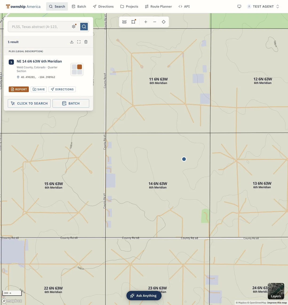
The check starts from the legal description, the same identifier on the deed and the purchase contract. Township America resolves PLSS legal descriptions to coordinates across 30+ PLSS states and 37 principal meridians, down to the aliquot part, so you enter the description rather than hunting for the tract on a basemap.
- Enter the legal description for the parcel. For example, the NE quarter of Section 14, Township 12 North, Range 78 West of the Sixth Principal Meridian resolves to the actual section and quarter-section boundary, not just a center point.
- Turn on the Federal Land pack. The parcel draws as a full boundary polygon, and the BLM Surface Management and PLAD public access layers render on and around it.
- Read the neighborhood. Note whether the adjoining ground is federal, which agency manages it, and whether public access is shown along any side that could carry a route to your tract.
- Save the Federal Land Diligence PDF. The pack produces one PDF for the parcel that captures what you saw, so it can go straight into a purchase file or a loan file for the next person who reviews it.
Because the boundary is a real BLM survey polygon rather than a dropped pin, you are reading the access layers against the parcel's actual edges, which matters when a route only touches one corner of the tract.
Flood, wetlands, and the rest of the same lookup
Access is rarely the only thing that constrains a rural tract, and the same lookup carries the rest of a Phase 1 pre-screen. The Federal Land pack is a 15-layer environmental pre-screen, so on the parcel you are already looking at you also get FEMA NFHL flood zones, USFWS NWI wetlands and critical habitat, NRCS SSURGO soils, USDA CDL crop history, USFS Wildfire Risk to Communities, and USGS 3DEP elevation.
For a landlocked-access question specifically, flood zones and wetlands matter because they can sit on top of the one corridor that would otherwise carry a road. A route that has to cross a mapped floodway or a wetland is a harder, more expensive route to permit and build, even where a legal easement exists. Seeing the access picture and those constraints on a single parcel view is what turns "there might be a way in" into a concrete question you can price.
What the Federal Land pack does not replace
This pre-screen does not confirm private easements, resolve title disputes, or replace an ASTM E1527-21 Phase 1 ESA. Escalate access concerns to a title professional and real estate attorney before closing.
Who the Federal Land pack is for
The Federal Land pack includes 100 parcel reports per month and attaches to Pro or Business. Business is priced per user; current prices are on the pricing page. It is built for people who check parcels often enough that a per-tract report does not fit: rural and ranch buyers screening a pipeline of listings, and rural lenders reviewing collateral before they commit. If you look at one tract a year, a subscription is more than you need. If access, flood, and soils questions come up on tract after tract, running them from the legal description on one lookup is what the pack is for.
If your work runs toward federal energy ground rather than rural land, the same approach to BLM surface data shows up in our note on siting solar and wind on BLM parcels. Either way, the move is the same: start from the legal description, read the federal layers against the real parcel boundary, and find the access problem before the closing table instead of after it. You can see the pack and plan pricing on the pricing page.