How to Convert Legal Land Description to GPS Coordinates
Convert legal land descriptions to GPS coordinates instantly across 30 US states. Supports PLSS (Public Land Survey System) with online lookup and map visualization.
To convert a legal land description to GPS coordinates, enter your PLSS description (e.g., NWSE 15-4N-7W Indian Meridian) into Township America's search box and press enter. The tool instantly returns latitude/longitude coordinates, displays the location on a map, and provides the option to export results in CSV, KML, or other formats.
Township America's intelligent search box enables you to locate millions of places across the United States using legal land descriptions, addresses, or geographic coordinates. It supports the Public Land Survey System (PLSS), geographic coordinates, and addresses. Visit our about page to learn more about the supported search queries.
Using the search box
The search box is the primary tool for finding locations on the map. It is located in the left panel on desktop or in a bottom drawer on mobile devices.
To search:
- Click the search box and type your search query
- As you type, suggestions appear based on your input
- Select a suggestion or press Enter to search
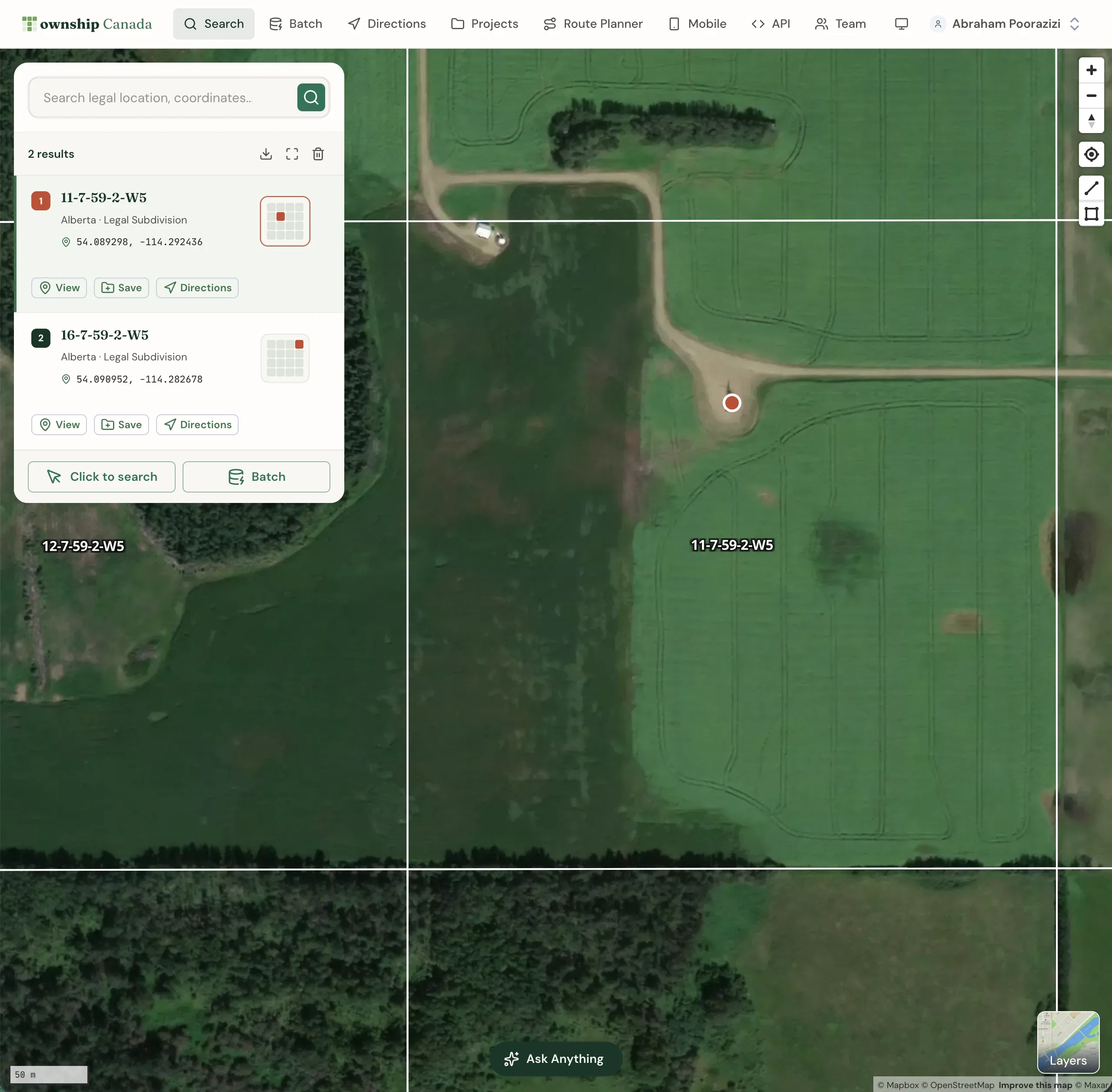
Search results appear both on the map and in the left panel. Each result displays the legal land description, geographic coordinates, and state.
Search result actions
Each search result card includes action buttons:
- View: Zoom to the location on the map
- Save: Add the location to Quick Saves or a Project
- Directions: Get turn-by-turn directions to this location
Click the result card to see additional details and the location's polygon boundary on the map.
Searching by legal land description
Township America supports the Public Land Survey System (PLSS), the standard survey system used across 30 US states.
Inputting a complete legal land description isn't mandatory; a partial description will also prompt suggestions. Choose a suggestion or press Enter to search with your input. Separate components of a legal land description with spaces, hyphens, or both (e.g., NWSE 15 4N 7W Indian Meridian, NWSE-15-4N-7W-Indian-Meridian).
State-specific examples
Colorado and Kansas (Sixth Principal Meridian)
The Sixth Principal Meridian covers Colorado, Kansas, Nebraska, Wyoming, and South Dakota. Examples of valid search formats:
- Section-Township-Range-Meridian: 14-5N-3W Sixth PM
- Quarter-Quarter Section: SENE 22 3S 68W 6th Meridian
Montana (Montana Principal Meridian)
Montana uses its own principal meridian. Example format:
- Quarter-Quarter Section: SWNE 22 3N 7E Montana Meridian
North Dakota (Fifth Principal Meridian)
North Dakota uses the Fifth Principal Meridian:
- Section-Township-Range: 8 100N 52W Fifth PM
- Section: 14 5N 3W 6th Meridian
Searching by geographic coordinates
Find locations using geographic coordinates such as GPS coordinates in formats like decimal degrees (e.g., 39.739236, -104.990251) and degree minute seconds (e.g., 39°44'21.2"N 104°59'24.9"W). The order of latitude and longitude is interchangeable, so both 39.739236, -104.990251 and -104.990251, 39.739236 are valid.
Searching by place names, addresses, or zip codes
To locate places and addresses, enter the name of a place, an address, or a zip code. The search box offers a list of suggestions as you type. Select a suggestion or press Enter to search with your current input.
Searching by clicking on the map
Find legal land descriptions, geographic coordinates, and addresses by clicking directly on the map. Select the Click to search button in the search panel, then click on your desired location. The results appear on the map and in the left panel.
Saving search results
Save locations from search results for future reference:
- Click the Save button on the search result card
- Choose Quick Saves or select a specific Project
- Add optional notes and categories
See the Projects guide for more about organizing saved locations.
Downloading search results
Download search results in various formats. Click the download button at the top of the results panel and select your preferred format:
- PDF: Formatted report (Pro and Business)
- CSV: For spreadsheet applications (Business)
- KML: For Google Earth (Business)
- Shapefile: For GIS software (Business)
- GeoJSON: For web mapping (Business)
- DXF: For CAD applications (Business)
Need to convert many locations at once? Check out our batch conversion guide to process thousands of records simultaneously.
Frequently Asked Questions
How do I convert a legal land description to GPS coordinates?
Enter your legal land description (e.g., NWSE 15-4N-7W Indian Meridian) into the Township America search box. The tool instantly converts it to GPS coordinates (latitude and longitude) and displays the location on the map. You can then copy the coordinates or download them in various formats.
What legal land description formats are supported?
Township America supports the Public Land Survey System (PLSS) used across 30 US states. Enter descriptions at any level: township-range, section, quarter section, or quarter-quarter section.
Can I convert GPS coordinates to a legal land description?
Yes. Enter GPS coordinates in decimal degrees (39.739236, -104.990251) or degrees-minutes-seconds format (39°44'21.2"N 104°59'24.9"W) to find the corresponding legal land description.
Is Township America free to use?
Township America offers three self-serve plans (Starter, Pro, Business). Visit our pricing page for details.
What file formats can I download results in?
Pro plans support PDF export. Business plans add CSV, Shapefile, GeoJSON, KML, and DXF. Starter plans do not include export options.
How accurate is the legal land description lookup?
Township America uses official survey grid data to provide accurate legal land descriptions. The tool covers all 30 PLSS states with survey grid systems, including the latest updates to grid boundaries.
Related Guides
Get Directions to Legal Land Descriptions | PLSS Navigation
Get driving directions to legal land descriptions, quarter sections, and PLSS locations. Navigate to remote well sites, field locations, and rural properties using PLSS coordinates with turn-by-turn instructions.
PLSS Grid Maps - Interactive US Survey Maps
Interactive maps with PLSS grids for 30 US states. View townships, ranges, sections, and quarter sections with satellite imagery and data layers.