Texas PSF Lands and State-Agency Surface: What the Texas Pack Shows for Surface Rights Due Diligence
Texas PSF land and state-agency surface can reshape a ranch or surface rights deal. See what the Texas pack surfaces before you make an offer.
A buyer works up a Texas ranch tract, reads the survey call, checks the appraisal district map, and lines up an offer. Then a title reviewer notices something the county viewer never flagged: part of the tract sits on Texas PSF land, and the surface is held by the state. That single fact can change who you negotiate the lease with, what access looks like, and whether the deal you priced is the deal you are actually buying. The problem is that most land tools never show it, so the discovery tends to arrive late, after the offer is already on the table.
This post explains what Texas PSF land and state-agency surface are, why they matter to a ranch or surface rights transaction, and what the Township America Texas data pack surfaces on a given tract so you can check before you commit.
What Texas PSF land is
The Permanent School Fund (PSF) is an endowment Texas created to support public education. To fund it, the state set aside large amounts of land, and it still holds surface and mineral estates on a significant share of that acreage today. The Texas General Land Office (GLO) manages these state-owned lands. Alongside PSF land, various Texas agencies hold surface for their own purposes, which is why "state-agency surface" belongs in the same conversation.
The practical point is ownership. When part of a tract is PSF land or state-agency surface, the counterparty for a lease, an easement, or an access agreement may be a state office rather than a private neighbor. That is not a defect in the deal, but it is a materially different transaction, and it is one you want to understand before you price the offer rather than after.
Why state ownership changes a surface rights deal
Surface rights buyers and ranch buyers care about who controls the ground, not only who holds the minerals. If the state is the surface owner on part of a tract, several things follow:
- The lessor or grantor you deal with changes, and so does the process for reaching an agreement.
- Access, grazing, and development terms may run through GLO or an agency rather than a private owner.
- A mineral estate evaluation shifts when the state, not a private party, is the surface or mineral holder, because that changes who you are negotiating with and under what terms.
None of this is a reason to walk away. It is a reason to know early. A buyer who learns about PSF or state-agency surface mid-diligence is repricing a deal under time pressure. A buyer who screens for it up front can shape the offer around it.
How the Texas pack surfaces PSF and state-agency land
Township America resolves the Texas Abstract, Block, and Survey (GLO) grid to coordinates for free on every plan, right alongside PLSS. That free grid resolver is the part no other PLSS converter offers, and it is how you locate a Texas tract that was never laid out on the rectangular survey. You can read more about the free grid in Texas land descriptions now in Township America.
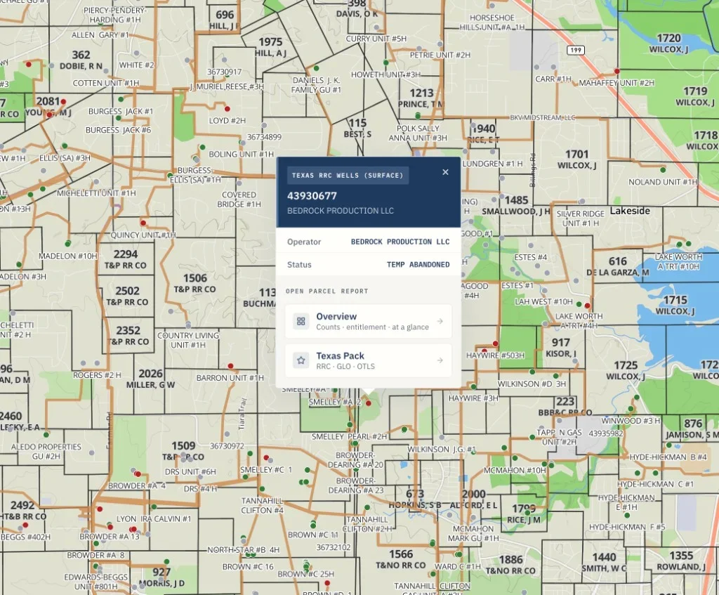
The paid data sits in the Texas pack, a set of 18 Texas layers that attach to a Pro or Business plan. One of those layers is PSF lands and state-agency surface. When you resolve a tract, the pack shows where state-owned surface intersects it, so overlap is something you can see on the map instead of something you hope the county records mention. Because the pack draws on Texas GLO and Permanent School Fund records, the state land layer sits in the same view as the GLO lease layer, which lets you read ownership and leasing together on one tract.
A worked example
Suppose you are evaluating a ranch parcel described the Texas way, by survey and abstract rather than by township and range, for example the H. and T.C. RR Co. Survey, Abstract 456. You paste that description into Township America, and the free grid resolver returns coordinates and the parcel boundary on the map.
With the Texas pack turned on, you add the state land layer and see that the western portion of the parcel overlaps PSF land. That overlap raises a specific set of questions before you make an offer:
- Which portion of the surface is state-held, and how much of the tract does it cover?
- Does the state surface carry an existing GLO lease, which the lease layer would show alongside it?
- How does the state ownership change access and any planned development on that portion?
The tool does not answer those questions for you, and it is not a title opinion or a survey. What it does is turn a hidden ownership fact into a visible one early enough to act on. From there you take the specific tract to GLO records and your title professional with a concrete question rather than a blank map.
When to add the Texas pack to your diligence
Screening for state land overlap earns its place in a few clear situations:
- Ranch acquisitions in regions where PSF and state-agency land is common, where a state surface owner changes the negotiation.
- Surface-only purchases, where who holds the surface is the whole point of the deal.
- Mineral estate evaluations, where state ownership changes the lessor and the terms.
If your Texas work rarely touches state land, the free grid resolver may be all you need. If it touches state land often, the pack pays for itself the first time it catches an overlap before an offer. Recommendations like this depend on your deal flow, so weigh it against the tracts you actually work.
What else the Texas pack includes
PSF and state-agency land is one layer among 18. The Texas pack also carries GLO leases and pooled units, RRC active wells, T-4 pipelines, W-1 pending permits, RRC lease production history with a production heatmap, UIC disposal and injection wells, and coastal layers for bay tracts, oyster, erosion, and shoreline change. Stack it with the Energy or Federal Land pack and the results roll up into one Combined Parcel Report PDF. For a look at the lease and well side of the pack in practice, see Permian Basin lease due diligence with the Texas pack.
State land overlap is one of the facts that can quietly reshape a Texas deal, and it is one of the hardest to see with county tools alone. If you buy or lease surface in Texas, checking for PSF and state-agency land before the offer is worth building into the workflow. You can start with the free grid resolver, and when the tracts warrant it, add the Texas pack from the pricing page. It fits the kind of surface work covered on our real estate and oil and gas pages.