PLSS for Mineral Rights Owners: How to Locate Your Parcel from a Legal Land Description
A mineral rights PLSS description like NWSE 14 T4N R22W is not a street address. Here is how to locate your parcel on a map from the legal land description.
A mineral rights deed lands in front of you, from an inheritance or a purchase in the Permian Basin or the Bakken, and it describes your property like this:
NWSE 14 T4N R22W
That is a mineral rights PLSS description, and it is not a street address. You cannot type it into a mapping app and get a pin. It is a coordinate in the Public Land Survey System (PLSS), the grid the federal government used to survey most of the western United States, and it points to a specific piece of ground measured in acres rather than in blocks and lot numbers.
This guide is for the owner, heir, or buyer who needs to find where that parcel actually sits. You will learn what each part of the description means, how to figure out the one piece deeds often leave off, and how to turn the whole string into coordinates and a parcel boundary on a map. It does not cover who owns the minerals or whether they are leased. Those are questions for a landman or a title attorney, and they start from the same location this guide helps you find.
Why a mineral deed uses a legal description, not an address
A street address describes a mailbox. A mineral estate has no mailbox. The oil and gas under a quarter-section can be owned separately from the surface above it, split among a dozen heirs, and leased to an operator who has never set foot on the land. To describe that precisely, the deed uses the survey grid the land was mapped with when it entered private ownership.
The practical consequence: the description is exact, but only if you can read it. A transposed range number or a misread aliquot part sends you to the wrong corner of the wrong section, sometimes miles from your actual parcel. Reading it correctly is the whole job.
The five parts of a mineral rights PLSS description
Take the example again, written out in full: NW¼ SE¼, Section 14, Township 4 North, Range 22 West. A complete PLSS legal description carries five pieces:
- Township: a horizontal row, six miles tall, numbered north or south of a baseline. T4N means the fourth row north.
- Range: a vertical column, six miles wide, numbered east or west of a principal meridian. R22W means the twenty-second column west.
- Section: one of the 36 square-mile blocks inside a township. Section 14 is one square mile, about 640 acres.
- Aliquot part: the slice of the section your deed covers. NWSE means the northwest quarter of the southeast quarter, which is 40 acres. Read aliquot parts right to left: start with the section, take the SE quarter, then the NW quarter of that. Our companion guide on how to read a mineral rights legal description walks through this in detail.
- Principal meridian: the reference line the range is counted from. There are 37 of them across the country, and this is the part deeds most often omit.
If you want a broader primer on the grid itself, the township and range system guide and the overview of what a legal land description is both go a level deeper than this article needs to.
Find your principal meridian and your state
The PLSS covers 30+ states and 37 principal meridians, and the meridian is what anchors your range count to a real place on the earth. Two deeds can both read "R22W" and describe parcels in different states, because each range is counted from its own meridian.
If your deed names the meridian, you are set. If it does not, the state and county on the deed usually narrow it to one candidate:
- North Dakota (Bakken counties like McKenzie and Williams): the Fifth Principal Meridian, as shown in the BLM cadastral reference.
- Oklahoma: the Indian Meridian covers most of it.
- New Mexico and parts of the Permian: the New Mexico Principal Meridian.
- Wyoming and Colorado: the 6th Principal Meridian covers most of both.
When the meridian on the deed does not match the state you expected, treat that as a signal to check the paperwork before you do anything else, not as something to guess your way past.
Step by step: from legal description to coordinates and a parcel boundary
Once you have all five parts, plotting the parcel takes about a minute:
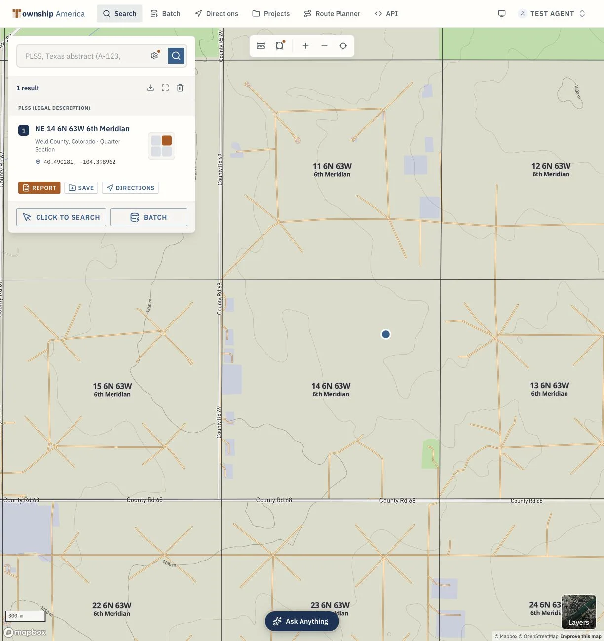
- Open the Township America PLSS converter. The search box takes a full legal description or the individual pieces.
- Enter the description as it reads on the deed: township, range, section, aliquot part, and meridian.
- Township America resolves it against official BLM survey data and returns the latitude and longitude for the tract, down to 10-acre aliquot parts.
- It draws the parcel outline on the map as the actual BLM survey boundary, not a point estimated from a formula, and shows the acreage and county.
For a single mineral deed, the Starter plan covers it: 100 searches, PLSS lookup, and the map. Keep labeled results with your deed records so future lease offers and title questions start from the same verified location.
When the description is incomplete or unusual
Old mineral deeds can be incomplete. Common problems:
- No meridian. Use the state and county to identify the likely principal meridian, as above, then enter it. If two meridians are plausible for that county, check both and compare the results against what you know about the land.
- An unusual aliquot string. Deeds sometimes stack three levels (like NE NW SW) or mix halves and quarters (like S½ NE¼). The right-to-left rule still holds. Enter the string exactly as written and confirm the acreage the tool returns matches what the deed says you own.
- A tract that spans more than one section. If the deed lists several sections, look up each one separately and read the boundaries together. Each lookup is its own parcel outline.
If a description will not resolve, review the meridian and section number with a professional rather than forcing a match.
After you find the parcel: boundaries, exports, and nearby production
Locating the tract is the first step. What you do next depends on why the parcel matters to you.
If you are working through an inherited stack of tracts across several states, Pro adds unlimited searches, satellite imagery, boundary drawing, and PDF export, so you can attach a labeled parcel map to your records for each deed. If your minerals sit in a producing state (Colorado, North Dakota, Oklahoma, Wyoming, or New Mexico), the Energy data pack on Pro or Business adds producing wells, BLM leases, and pipeline layers, which lets you screen what is active near your parcel before you talk to an operator. That kind of screening is common in oil and gas work and increasingly useful to the individual owner.
The paperwork stops feeling like code the moment the description on your deed becomes a shape on a map. Read the five parts, pin down the meridian, plot it, and you have turned a mineral rights PLSS description into a place you can actually point to.