Kansas PLSS Guide: 6th Principal Meridian, the Winter Wheat Belt, and Federal Land Diligence for Farmland Investors
A Kansas PLSS converter guide: read a legal description off the 6th Principal Meridian, then screen farmland with NRCS soils, crop history, and flood layers.
An ag lender in Hutchinson gets a loan request against a half section of wheat ground, and the parcel arrives the way rural land always does: as a legal description, not a map pin. Before the loan commitment, someone has to confirm the soil class, the recent crop history, and whether any of the acreage sits in a FEMA flood zone. None of those datasets are keyed to a section, township, and range, which is where the work starts. A Kansas PLSS converter turns that description into verified coordinates and a parcel boundary, and from there the federal diligence layers line up on the same map. This guide covers how Kansas builds its grid off the 6th Principal Meridian, who reads these descriptions, and how to screen wheat-belt farmland before a bid or a loan commitment.
One meridian, ranges east and west
Kansas is a single-meridian state, which makes its grid simpler than a state like Colorado that counts from three principal meridians. Every Kansas legal description references the 6th Principal Meridian, so the meridian line rarely changes the answer. The trap in Kansas is a different one: the range direction.
The 6th Principal Meridian's initial point sits on the Kansas-Nebraska border in Republic County, Kansas, where the baseline runs along the 40th parallel. Because Kansas lies entirely south of that baseline, every township in the state is numbered south, from T1S near the Nebraska line down to the mid-thirties at the Oklahoma border. The meridian itself runs north and south through the north-central part of the state, so Kansas parcels sit on both sides of it. Ranges climb east toward Missouri and west toward Colorado.
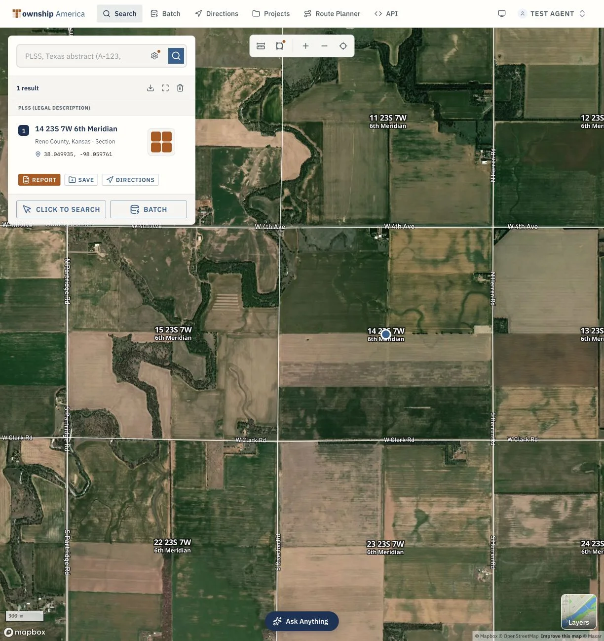
That last point is the one that costs money. A central wheat-belt description might read T23S R7W Sec 14, 6th Principal Meridian, which places you in Reno County near Hutchinson. T23S is the twenty-third tier of townships south of the baseline, R7W is the seventh range west of the meridian, and Sec 14 is one of the 36 one-mile sections in that township. Add an aliquot part such as SW¼NE¼ Sec 14 and you read it right to left: the southwest quarter of the northeast quarter, a 40-acre tract, not 160. Now change one letter. R7W and R7E are both valid Kansas ranges, and they sit roughly a hundred miles apart on opposite sides of the meridian. A description that drops the direction, or transposes it, reads cleanly and lands in the wrong county. In a single-meridian state, the range direction does the work the meridian does elsewhere, so it is the part of a Kansas description you cannot leave off. For a refresher on how townships and ranges are numbered off a baseline and meridian, the township and range system guide covers the structure.
Put a Kansas legal description on the map
Enter a full Kansas description, range direction included, into the Kansas PLSS converter and it returns verified latitude and longitude plus the parcel drawn on a map. Resolution runs down to the 1/256 aliquot part, which is 2.5 acres, across 30+ PLSS states and 37 principal meridians. The math is calculated from official BLM survey data (the GCDB and CadNSDI), not estimated from a grid formula.
That distinction matters for farmland, where value follows the boundary. A centroid guessed from a Township and Range formula can sit well off the real survey line, which is enough to misstate which soils or which flood acreage fall inside the tract. Township America returns the actual section and quarter-section boundary as a GeoJSON polygon, reflecting the BLM survey of the described parcel, not just a center point. The converter also runs in reverse, so a set of coordinates from the field resolves back to the legal description.
Federal Land pack layers for Kansas farmland
Coordinates put the parcel on the map. The federal diligence data is what a lender or investor is really after, and the Federal Land pack (available on Pro or Business) overlays it on the same parcel. The pack is a 15-layer Phase 1 environmental pre-screen. For Kansas farmland, the layers that carry the most weight are:
- NRCS SSURGO soils, the Soil Survey Geographic database, which classifies the dirt the crop actually grows in.
- USDA CDL crop history, the Cropland Data Layer, which shows what has been planted on the tract in recent years.
- FEMA NFHL flood zones, the National Flood Hazard Layer, which flags acreage in a mapped floodplain.
- USFWS NWI wetlands and critical habitat, the National Wetlands Inventory, which surfaces wet ground and protected areas.
The pack also carries USFS Wildfire Risk to Communities, BLM Surface Management and PLAD public access, and USGS 3DEP elevation, and it rolls the whole set into a Federal Land Diligence PDF for the tract. One caveat matters for how you use it: this is a pre-screen, not a substitute for an ASTM E1527-21 Phase 1 environmental site assessment. It is early diligence that tells you where to look, not a final environmental clearance. The agriculture industry overview covers how the pack fits farmland work.
An ag lender's workflow, from legal description to PDF
The value shows up when the steps run in one place instead of four separate systems. A lender screening a Kansas wheat tract before a loan commitment can move straight through:
- Enter the legal description, range direction and all, and get verified coordinates plus the section polygon.
- Turn on the NRCS SSURGO layer to read the soil classes across the tract, not just at a point.
- Check the USDA CDL crop history to confirm the ground has actually been farmed the way the borrower represents.
- Read the FEMA NFHL and USFWS NWI layers to see whether any collateral acreage sits in a flood zone or wetland.
- Export the Federal Land Diligence PDF to attach to the loan file.
The point is that every layer references the same parcel boundary, so the soil, crop, and flood picture all describe the same acres the loan is secured against.
Put a Kansas parcel on the map
Kansas rewards one habit above the rest: write the range direction on every description, because in a single-meridian state that letter is the difference between the tract you meant and one a hundred miles away. Once the description is on the grid, the federal diligence layers a farmland lender or investor needs sit on the same parcel.
Paste any Kansas PLSS legal description into the Kansas PLSS converter and you get verified latitude and longitude plus the section polygon in seconds, resolved against BLM survey data. Screening a whole book of tracts across a lending portfolio or a fund's target list? On the Business plan, batch conversion turns a CSV of descriptions into coordinates and boundaries in one pass, with structured exports (CSV, KML, Shapefile, GeoJSON, and DXF) to drop into QGIS or ArcGIS. See the plans and Federal Land pack pricing for the base plan plus the pack that carries the soils, crop history, and flood layers.