FracFocus Disclosure Data in the Energy Pack: Screening Hydraulic Fracturing Activity Near a Parcel
Screen FracFocus hydraulic fracturing disclosures on a PLSS legal description with the Energy pack, and know when a parcel needs a full Phase 1 ESA.
When a lender or an environmental consultant runs early diligence on a rural or industrial parcel, one question comes up by name: has this ground been hydraulically fractured, and if so, what was pumped into it? For oil and gas tracts, the answer usually starts at FracFocus, the national hydraulic fracturing chemical disclosure registry. The catch is that FracFocus is organized by well and API number, not by the PLSS legal description a diligence file is built around. Lining up a disclosure with the section you are screening means cross-referencing coordinates by hand. This post explains what FracFocus records, how the Energy pack surfaces those disclosures directly on a PLSS legal description, and where a quick screen ends and a full Phase 1 ESA begins.
What FracFocus records, and why diligence asks for it
FracFocus is run by the Ground Water Protection Council and the Interstate Oil and Gas Compact Commission, and more than 30 states use it as their official disclosure channel for hydraulic fracturing. Each filing ties to a single well and typically includes the operator, the well API number, the county and state, the well's latitude and longitude, the fracture date, the true vertical depth, the total base water volume, and the list of chemical ingredients with their CAS numbers and maximum concentrations.
Lenders and Phase 1 practitioners ask for a FracFocus check because it is a fast, public record of subsurface activity that a title search will not show. A disclosure near a parcel tells you an operator fractured a nearby well, roughly when, and how deep. That is an early signal about offset activity and potential subsurface risk, gathered before anyone commissions a full site assessment.
Screen by PLSS legal description, not by API number
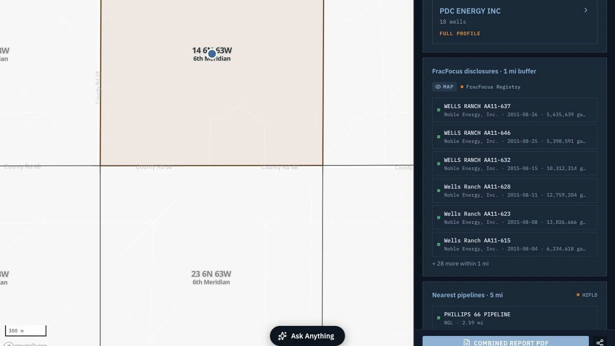
The Energy pack changes the entry point. Instead of querying FracFocus by well, you enter the tract once as a PLSS legal description, for example Section 14, Township 7 North, Range 58 West of the Sixth Principal Meridian in Weld County, Colorado, and the pack overlays FracFocus disclosures on the same grid as the parcel. Township America resolves that description to the actual BLM survey boundary, down to the 1/256 aliquot part, across all 30 PLSS states and 37 principal meridians. FracFocus filings then render against that boundary, so you see which disclosures fall on or near the section without matching coordinates by hand.
Reading a hit
A FracFocus overlay answers three practical questions at a glance: who, when, and how deep. The operator and API number identify the well and let you pull the full filing. The fracture date places the activity in time, which matters for a lender comparing it against a loan or acquisition timeline. The true vertical depth separates surface concerns from deep subsurface ones: a disclosure at 8,000 feet describes activity far below the root zone and most shallow groundwater, while a shallow completion sits closer to the surface interests a Phase 1 weighs.
Proximity is the other axis. A disclosure two sections away carries different weight than one on the quarter-section you are screening, and seeing both on the same map makes that judgment quick rather than speculative.
One session, several layers
FracFocus rarely travels alone in a diligence file. In the same session, the Energy pack overlays the USGS orphaned-wells liability screen and BLM oil and gas leases against the same PLSS legal description. An orphaned well nearby is a liability flag a FracFocus filing will not surface, and a BLM lease tells you the mineral estate may be active and federally administered. Screening all three at once, on one grid, is the difference between a single disclosure check and an early picture of who holds what and where the liabilities sit. The pack rolls the result into a Federal Energy Report PDF you can attach to the file. Teams doing the same work around a specific bore can pair it with well-site planning in the same tool.
When a screen is enough, and when it is not
A FracFocus screen is an early flag, not a site assessment. It tells you fracturing activity is disclosed near a parcel and gives you the operator, timing, and depth to reason about it. It does not evaluate soil or groundwater impact, and it is not a Phase 1 Environmental Site Assessment. When a transaction needs the liability protections of a formal assessment, a Phase 1 ESA under ASTM E1527-21, performed by an environmental professional, is the deliverable, and the FracFocus screen becomes one input to it. For screening across a pipeline of parcels, or for a first look before committing to that cost, the Energy pack check is often enough to decide which tracts warrant a closer look. That first-look economics is the same reason ag lenders reach for a pre-screen instead of ordering a full assessment on every file.
The Energy pack is $150 per month and attaches to a Pro ($20 per month) or Business ($40 per month) plan, so a screening setup starts at $170 per month (see pricing for the full pack lineup). If FracFocus, offset wells, and orphaned-well liability are recurring questions in your diligence, screening them by PLSS legal description keeps the answer on the same grid as the rest of the file.