Batch PLSS Conversion for Rural Insurance: CSV Upload and Structured Export for a Book of Policies
Batch PLSS to GPS for rural insurance: upload a CSV of legal descriptions, get coordinates and parcel boundaries back, and export to the formats your rating and GIS systems read.
A book of rural policies is keyed to land, not to street addresses. A crop policy or a farm dwelling is written against a legal land description like "SWNE 22 9N 15W, Indian Meridian," which reads as the southwest quarter of the northeast quarter of Section 22, Township 9 North, Range 15 West. That format is precise for a surveyor and useless for a rating engine or a GIS layer, both of which expect coordinates. When you need to price risk across a whole book, or verify where a reported loss actually sits, you have to turn hundreds or thousands of those rows into latitude and longitude first. Doing it one row at a time is where the days go. A batch PLSS to GPS conversion turns that job into a single upload, and this post walks through the workflow and names which plan covers each part of it.
Why row-by-row conversion is the wrong tool for a book
The single-lookup approach works when you have one description. It stops working at volume for two reasons, and both cost money rather than just time.
The first is transcription error. Every time an adjuster copies a description into a lookup tool and pastes coordinates back into a spreadsheet, there is a chance to transpose a range number or drop an aliquot part. "9N 15W" becoming "9N 16W" moves the parcel six miles west, and nothing downstream flags it. In a rating context, that error is silent until a claim exposes it.
The second is that a point is not a parcel. A single lookup usually returns a centroid, one pair of coordinates for the middle of the described land. That is enough to drop a pin, but it does not tell you the shape or the extent of the parcel, which is what you need to check whether a flood zone, a wildfire perimeter, or a reported loss location intersects the insured land. For a book of policies, you want the boundary, not just the center.
The batch workflow: upload the book, get the whole file back
The batch converter inverts the manual process. Instead of moving one row at a time, you send the book once and receive it enriched.
- Export your policies to a CSV or Excel file with the legal descriptions in a column. The how-to guide covers the exact column format.
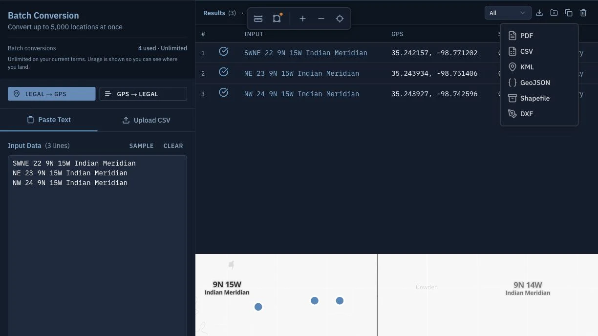
- Upload the file. Township America converts thousands of legal descriptions to coordinates in one pass, so a full book is a single operation rather than a multi-day queue.
- Download the results with coordinates and parcel boundaries attached, ready to load into your rating system or GIS.
Because the conversion runs against the whole file at once, the failure mode changes. Instead of scattered manual typos, any rows that cannot be resolved come back as a reviewable list, so you correct a handful of malformed descriptions rather than auditing the entire book by hand.
Which export format fits which system
The reason batch conversion supports several export formats is that the coordinates rarely stop with you. They feed another system, and each downstream system reads a different file. Batch conversion exports to CSV, KML, Shapefile, GeoJSON, and DXF, which covers the common destinations:
- CSV loads back into a spreadsheet or a rating engine that expects tabular latitude and longitude next to each policy row.
- Shapefile and GeoJSON carry the full parcel geometry into GIS tools like QGIS or ArcGIS, so an analyst can overlay the book against hazard layers.
- KML drops the parcels onto a Google Earth view for a quick visual check of where a cluster of policies sits.
- DXF hands the geometry to CAD software when an engineering or survey workflow needs it.
If your book only ever lands in a rating spreadsheet, CSV is the whole story. If a hazard analyst works the same book in GIS, the boundary formats are what make the export worth keeping. Choose the format for the destination, not the other way around.
Accuracy: resolved from BLM survey data
The conversion is only as trustworthy as the survey data behind it. Every row is resolved from official Bureau of Land Management survey data, across all 30 PLSS states and 37 principal meridians, and Township America returns the full GeoJSON polygon of the actual survey boundary rather than an approximated box. A quarter section resolves to its 160 acres, and the aliquot parts go finer, down to the 1/256 part, roughly 10 acres, when the description calls for it.
One practical note for a national book: if some policies sit in Texas, those parcels are often described on the Abstract, Block, and Survey grid from the General Land Office rather than by PLSS. Township America resolves that Texas grid too, alongside PLSS, so a mixed book does not force a separate tool for the Texas rows.
Which plan includes batch and structured exports
Batch conversion and the structured exports (CSV, KML, Shapefile, GeoJSON, DXF) are part of the Business plan, which is $40 per user per month and includes unlimited usage. That tier exists for exactly this pattern: once you are converting a book rather than a single description, the volume is the reason to move up, and the structured exports are what get the results into your rating and GIS systems. The Starter and Pro plans handle single and unlimited interactive lookups, but the batch upload and the file exports are Business features.
If your work is occasional one-off checks, the interactive converter on a lower tier is enough. If you maintain a book of rural policies and re-price or re-verify it on a schedule, batch conversion is the part that turns a multi-day data-entry task into one upload and one download.