Wildfire Risk Pre-Screen for Rural Properties: USFS Hazard Layers and the Federal Land Pack
Wildfire risk is now part of rural property diligence. See how the Federal Land pack overlays USFS hazard layers on any PLSS legal description in one search.
A rural appraiser or an ag lender working a file on a mountain-valley tract now has to answer a question that was rarely asked five years ago: how exposed is this parcel to wildfire? Wildfire risk has moved into rural property diligence the same way flood zones did a generation ago, and it shows up in appraisal narratives, insurer questionnaires, and loan underwriting. The data to answer it is public and comes from the US Forest Service, but it is published as a national raster keyed to geography, not to the legal description on the deed. That gap, between a PLSS legal description and a federal hazard layer, is where a pre-screen either happens quickly or stalls in a GIS backlog.
This post walks through what the USFS wildfire layer actually measures, how the Federal Land pack overlays it on a PLSS parcel in a single search, and where the boundary of a pre-screen sits.
Why wildfire risk entered rural property diligence
For a long time, wildfire exposure was treated as an insurance question and left with the carrier. That has changed. Insurers now price and sometimes decline rural coverage based on modeled wildfire risk, which means a buyer can close on a farmstead or a recreational tract and then struggle to insure it. Lenders noticed, because an uninsurable structure is weak collateral. As a result, wildfire exposure increasingly appears alongside flood and wetland checks in the early read on a rural parcel.
The practical problem is timing. Appraisers and loan officers work on short clocks, and the wildfire question tends to arrive late, often after an offer is already moving. A pre-screen that returns a wildfire reading in the same pass as flood and soils lets the team flag a high-exposure tract before the file gets expensive, rather than after.
What the USFS Wildfire Risk to Communities layer measures
Wildfire Risk to Communities is a national dataset published by the USDA Forest Service. It is worth being precise about what it does and does not say, because the wording matters when it goes into a file.
The dataset models two underlying things and combines them. The first is wildfire likelihood, an estimate of the annual chance that a given location burns, derived from fuels, weather, terrain, and historical fire behavior. The second is intensity, how severe a fire would be if one occurred. Combining likelihood and intensity with the presence of things that can be harmed produces a risk reading. The published product expresses that reading in relative classes, from very low up to very high, rather than as a single insurable probability.
This means a "high" or "very high" rating is a comparative signal, not a prediction that a specific parcel will burn in a specific year. It tells you that, relative to the rest of the country, this location sits in the upper range of modeled exposure and deserves a closer look. Treat the class as a screening flag that routes the file toward a fire risk survey or an insurer conversation, not as a determination on its own.
Running the check on a PLSS legal description
The reason the USFS layer rarely gets checked at intake is friction. Querying it parcel by parcel normally means loading the national raster into a desktop GIS, locating the tract, and reading the pixel under it, which assumes the staff, the software, and current layers are all on hand. Most rural lending and appraisal teams do not keep that setup running.
The Federal Land pack removes that step. You enter the legal description and the pack resolves it against official BLM survey data, then overlays the wildfire layer and the rest of the federal hazard stack on the parcel, with no GIS software involved. Township America resolves PLSS descriptions across 30 states and 37 principal meridians, down to the quarter-quarter aliquot (about 10 acres), so the read lands on the described tract rather than a rough pin.
For example, an appraiser looking at the NW quarter of Section 14, Township 22 North, Range 8 West, Montana Principal Meridian, can enter that description and see the wildfire class for the parcel together with its flood, wetland, and soils readings, in one lookup. The output follows the actual survey boundary of the quarter section, not just a centroid, so a tract that straddles a risk break shows the split rather than averaging it away.
The other diligence layers in the same lookup
Wildfire is one reading in a 15-layer pre-screen, and the value is in getting the rest without a second workflow. The Federal Land pack ($80/mo, on top of a Pro or Business plan) overlays the following federal layers on the same parcel:
- USFS Wildfire Risk to Communities, for modeled wildfire likelihood and intensity
- FEMA NFHL flood zones, for base flood elevation and special flood hazard areas
- USFWS NWI wetlands and critical habitat, for permitting and endangered-species exposure
- NRCS SSURGO soils and USDA CDL crop history, for productivity and land-use context
- BLM Surface Management and PLAD public access, for adjacent federal surface and access rights
- USGS 3DEP elevation, for terrain and slope
Each of these comes from a federal source (FEMA, USFWS, NRCS, USDA, USFS, BLM, and USGS), so the readings are public-record and consistent from one parcel to the next. For an ag lender, the combination of wildfire class, flood zone, and SSURGO soils on a single agriculture file is often enough to sort a tract into "clean" or "needs a closer look" at intake. For a real estate buyer or a forestry manager, the wildfire and elevation layers together give a fast read on defensible-space and access questions.
The Federal Land Diligence PDF
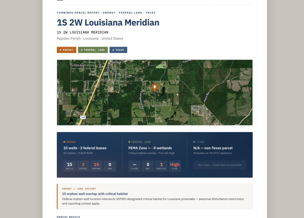
A reading is only useful in a file if it can travel with the file. The pack produces a Federal Land Diligence PDF that captures the layers checked on the parcel, which an appraiser can attach to a report or a loan officer can drop into the underwriting package. When more than one pack is active on the account, the stacked layers roll up into one Combined Parcel Report PDF, so a lender who also runs the Energy or Texas pack gets a single document rather than three.
The document records what was pulled and when, which is the point for diligence: it shows the wildfire and hazard screen was run at intake, against a named legal description, from federal sources.
What the pre-screen is not
This is a pre-screen, and the label is deliberate. It is not a substitute for an ASTM E1527-21 Phase 1 Environmental Site Assessment, and it is not a fire risk survey. It reads public federal layers against the legal description and flags exposure early; it does not send an environmental professional to the property, evaluate defensible space on the ground, or certify insurability. A "very high" wildfire class is a reason to commission that further work, not a finding that replaces it.
Used with that boundary in mind, the wildfire pre-screen does one useful thing well. It puts a federal wildfire reading, keyed to the PLSS legal description, in front of the appraiser or lender at the start of the file instead of the end. You can see how the Federal Land pack attaches to a Pro or Business plan, and if you are new to reading legal descriptions, the township and range guide covers the format the pre-screen runs on.